|
 |
TRAVEL
THROUGH TIME
WITH
THE CONTINENTS
|
|
|
Did
you know that?
Chester
and the rest of our country, the
UK, used to be near the SOUTH
POLE!
In
250 million years time, the UK
will be near the North Pole, and
the world will look very
different.
The
sandstone in the hills near
Chester was formed in a
DESERT, 225 million years ago.
|
These
strange facts are true because the
continents are, very slowly, moving.
The
Earth's crust is
formed of several very large
pieces, known as 'plates'.
This
idea is called 'plate
tectonics' ('tectonics'
means 'building').
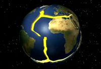
This
animation shows the
plates, with their edges
shown in red.
|
Animation
from US
Geological
Survey
|
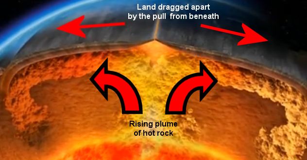
Powerful
currents beneath the crust, in the
liquid-like rock beneath, move the
plates over millions of years.
 Base
image from BBC series 'The Power of
the Planet' Base
image from BBC series 'The Power of
the Planet'
|
|
|
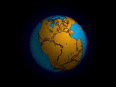
The
animation below shows
how today's continents
were once part of a super
continent called Pangea.
When
this began to break up,
200 million years ago, our
continents were formed.
They
then began to move slowly
into the positions they
are in today.
|
Animation
from US Geological Survey
|
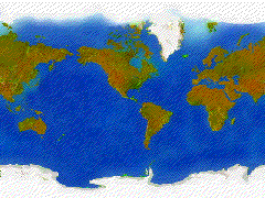
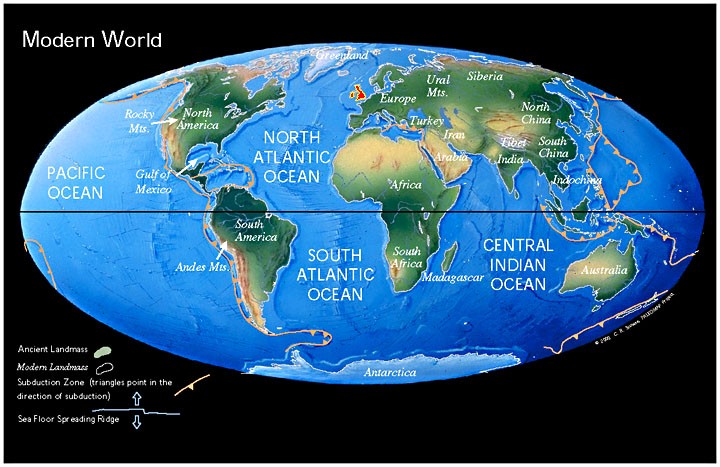
Look
at the map of the world below -
the
UK is shown in red.
|
|
 |
Now
scroll down the page to
travel
through time
with
our country!
|
|
THE
UK'S JOURNEY FROM SOUTH POLE
TO
NORTH POLE
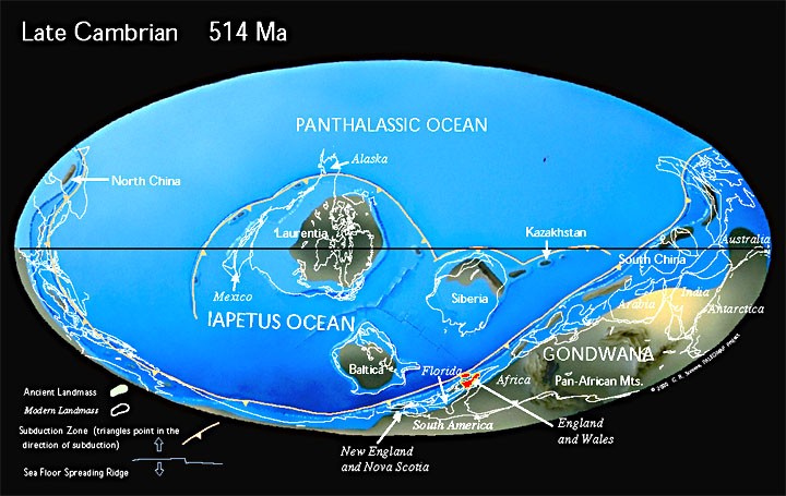
Here
is where the journey starts - 514
million years ago.
Can you see
the UK (England & Wales labelled)
right down near the South Pole, at the
bottom of the map?
|
|
514
million
years
ago
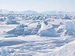
UK was
cold,
near the South
Pole
|
|
|
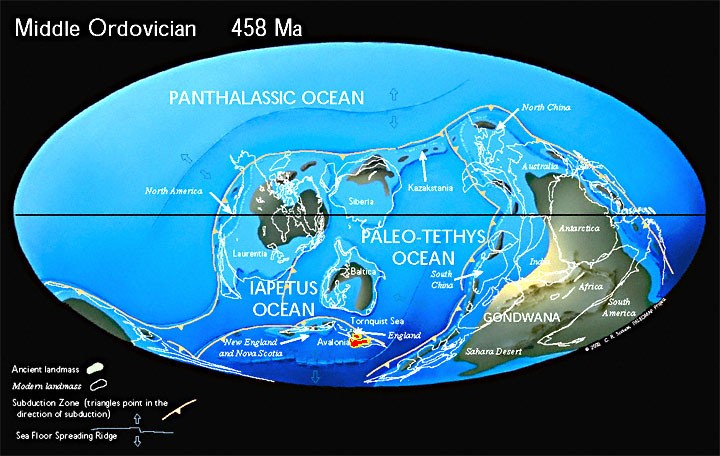
458
million
years
ago
|
|
|
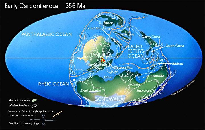
356
million
years
ago

Wet,
tropical forests
in the UK
(which turned slowly into coal over
millions of years)
|
|
|
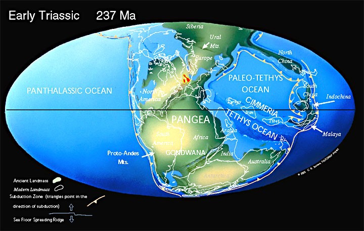
237
million
years
ago
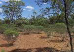
UK was
almost
a desert

Cheshire sandstone
begins to form |
|
|
Today
|
|
| |
Now
we travel into the far future!
|
|
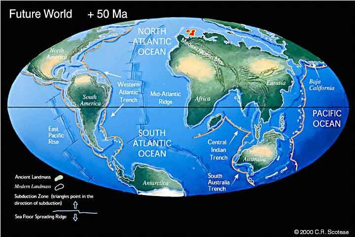
50
million
years
in the
future!
|
|
|
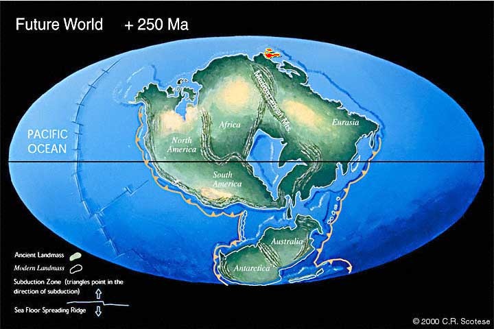
250
million
years
in the
future!
Back into the freezer
again for
the UK,
up near
the
North
Pole!
|
|
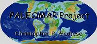
The
marvellous maps on this page are from
the Paleomap
Project by
Christopher
R Scotese
UK
simplified and coloured by Mr Rose -
the north and south of the UK and
Ireland
were
not connected until 300 million years
ago, when Pangea formed.
|
|
|